|
|
|
|
Interactive
Atlas®
|
||
|
|
||
Atlas Overview |
|||
|
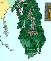
The Forgotten Realms Interactive
Atlas (FR Atlas) contains over 800
hot-linked maps of the largest and most successful RPG campaign ever. Every
map has been beautifully rendered using CC2 Pro, ProFantasy Software’s mapping
program. It’s a great resource for Realms fans and other gamers alike.
Almost the entire Realms has been detailed,
including many never-before-seen areas created specially for the FR Atlas. |
|||
|
|
Navigation is easy. Using the powerful globe feature, you can quickly select continents. Click on marked areas to open up whole countries. Select the cities to see the city maps. Even the important individual buildings have been detailed. Because the maps are in vector format, you can zoom in with no loss of detail. You can print maps at any size, with secret features hidden if you wish. You can edit the maps using CC2, or with AD&D® Core Rules 2.0 Campaign Mapper. The FR Atlas also contains over 500 symbols for CC2 users. CC3 versions of the symbols are available from the Support page. |
||
|
The Forgotten
Realms and the Forgotten Realms logo, AD&D and Core Rules 2.0 are
registered trademarks of Wizards of the Coast, Inc. CC2 and Campaign
Cartographer 2 are trademarks of ProFantasy Software Ltd. This website is
copyright 2000. Contact the webmaster
with any queries. |
|||


